Zone d'identification
Cote
Titre
Date(s)
- 29 Jul 1849 (Création/Production)
Niveau de description
Étendue matérielle et support
1 letter
Zone du contexte
Nom du producteur
Histoire archivistique
Source immédiate d'acquisition ou de transfert
Zone du contenu et de la structure
Portée et contenu
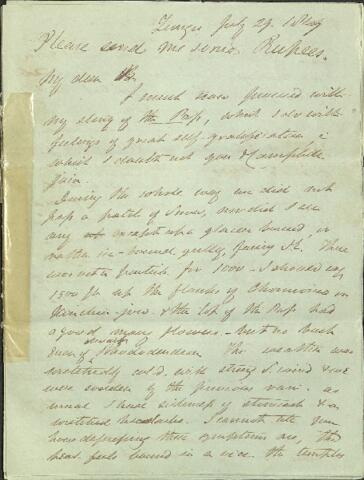
Tungu July 29 1849
Please send me some Rupees
My dear B
I must now proceed with my story of the Pass which I do with feelings of great self-gratification, in which I doubt not you and Campbell join. During the whole way we did not pass a patch of snow, nor did I see any except up a glacier bound or rather ice-bound gully facing [S.E.] There was not a particle for 1000 - I should say 1500ft up the flanks of Chomiomo in Kinchin - jow and the top of the pass had a good many flowers - but no bush even of dwarf Rhododendron. The weather was wretchedly cold, with strong S. wind and we were sodden by the previous rain as usual I have sickness of stomach and a wretched headache. I cannot tell you how depressing these symptoms are, the head feels bound in a vice, the temples throb at every step and when I stoop the feeling is as if a knife went through the brain. These headaches last all night and till next morning. I can't eat when I get back to camp and I call Heaven to witness that I'll never go up to 15,000 again. Geree lies N.W., if I made out aright from the top of the pass and its water's flow into the Thlonok by the lateral valley west of the Zemy on which I dwelt at some length in June the way is difficult and hardly frequented but crosses no height so great as Kongra Lama, than which Geree is considerably lower - Kambajong the military part (not Geree as I erroneously told you) is half a day N.W. of Geree and its waters flow into the Arun! this I had from 4 independent authorities. The first water shed into the Yarron is consierably N. of Kambajong! This if true is most marvellous, for Kambajong must be well East of Kinchin. All the country south of Kambajong and thence south of the road to Dobtah i.e. at the back of Kinchin, is a tractless mass of mountains, high but not much snowed Kinchin is visible from Dobtah alone, but from no where East of that. Now as far as I can guess the relative positions of these place is thus - see other sheet
[DRAWING OF A MAP]
Now the Patchien flows we all know N.W. into the Yarron and if these other watersheds are right, I can only reconcile them with the idea of a triangular lofty plateau, from Powhunry beyond Kinchin, pointing towards the Yarron dipping N.E. to the Patchien and N.W. to the Arun water sheds. After all river sheds and water courses are much anomalous and inexplicable in all table-land and plain countries e.g. the African rivers and the Australian where [?] elevations throw waters out if all reclining and where rivers cut slap through the principal mountain chains. One thing I think is certain, that the Teesta sources and the Arun are both between Kinchin and Powhunry and are an [?] way behind the main range, or any range. I fancy Turner's water shed if the Patchien is like this of the Lachen. All the people tell me that Pari flat is a flat in a very broad valley - such a plateau as there but twice as big and I can quite suppose the true Pass N. of Chumulari is like the Kongra Lama and with the features of K.L. Turner's description precisely tallies - my conclusions we know tend to the grandiose and the existence of such remarkable breaks in the chain between Chumulari and Kinchin and the throwing back of the water shed being opposite the Bay of Bengal must have some bearing if we agree with Humboldt, Lyell, Sedgwick and Dean Cockburn that all thr world has been under water. I ascended Chomiomo to I guess 17,000ft the other day, on a due S. exposure, but did not meet with a particle of snow there except what fell the previous night for we had a good fall at 14,000ft upwards and 4 inches fell on Kongra Lama. I cam on Chomiomo to the flat top of a ridge of flat stones, which suddenly dipped N and the snow fell and fogs were so thick I dare not go further. Yesterday I made a grand effort for the Perpetual Snow of Kichin-Jow. I went up the Tungu Choo which flows via Kinchin-Jow S. West to the Lachen at Tungu. The road is good - at 10,000ft the stream runs tranquil and pools for miles as does the Lachen at 15,000ft was beautiful rolling plains and hills, no where above 16,000 ft to which the ridge between the Tungu Choo and Lachen rose in isolated low sloping knolls. These flats are all grassy and beautiful, the Tungu Choo runs in a very broad flat bottomed valley amongst them and every where are back "Tents" of Thibetan Argali sheep and wool goats of two varieties - it is a splendid place I have been twice over these flats once on pony back gallopping for miles and miles in every direction as free as the wind. Kinchin-Jow rises out of these undulating meadows on to which it is planted by short abrupt [?] [?] on to which it abruptly descends in snowy precipices divided in this case by a [foss/fose?] - the water drain = which [foss/fose?] is deep broad bottomed - abruptly divides perpetual snow and rocky debris from grass meadow-land. The ascent from 15,000 to 17,000ft was very slow and slight at 17,000ft I came abruptly on s steep rocky narrow spur of rick and a little beyond it, on the Perpetual Snow in sheer cliffs of ice and snow reaching to the summit. i.e. 4000ft high, and several hundred thick. Kinchin-Jow you know presents a [wall?] face to the South. my course was North to about the middle of the mass of Kinchin, and so steep is this wall and little broken by [?] angles, that this tremendous snow barrier, stretched E and W at a uniform level for many miles. It was a most stupendous sight. Unfortunately the weather was very bad, a dense curtain of mist hung over all the upper part of the Mts. from under which the great snow bed descended [?] on a cliff of [debris?] to the East and against a short rocky spur to the West. I never conceived any thing so grant with your hands you might almost touch the snow the grass and rock. It snowed and sleeted more heavily than I ever saw it in the Himal. and we could get no shelter, for the ice and rock were too dangerous to crouch under - We spend two hours most wretched ones as [usual?] and I took Temp of Boiling Water most carefully - Now the water of all this tremendous mass of snow is, for 5 miles at least, collected into a stream which as the height of the [?] you might drink it up! and which for 4 miles doe snot flow at all. For many furlongs you see no drainage whatever from the Snow. I asked many people about the table-land and have collected much curious information. It snows here at 15,000ft not uncommon throughout the Summer. The other night 4 miles thick fell, the same as at Kongra Lama but neither this nor two nights rain, not the literally [?] snow and sleet I experienced swells the Tungu Choo, to speak of. The people laugh when I speak of this. Country rivers in comparison with the drainage of Kinchin Junga and all the ranges south of this. They say this is Cheen - the same Cheen that goes from Samdong to [Dijauli?] and the sun [takes?] up above snow water! we drink snow in Winter, in Summer catch the cloud in the little rills and pools you see - I was very much struck with the river or rather [hill] courses of this table-land south of Kinchinjow, and the impossibility of tracing these courses and even on finding the way without compass or guide, the elevations are so low and the valleys so [?] and similar. The people tell me that in Chien there are no villages off the main road, nor any roads but the main. This and their utter ignorance of the compass, or Pole-star is incompatible with their being any extent of plain and I am inclined to abolish that word, as being necessarily comparative with the plains of India of Africa, of Australia, or La Plata[e?] and [professing] that we confine ourselves to the terai plateau and Table-land neither of which involve my idea of continuity of level surface - such as the afore-said countries present. I have read Strachey with some profit; though it contains nothing absolutely new, it is the best expose of facts I have seen - still he stumbles sadly and it is neither the [?] a man of [?] nor gentleman. I shall have heaps of notes for you - it is not worth your while taking up the matter of the note to which in any discussion I maintain as to the Sub.Himal. I shall not even allude. Profound contempt is all it deserves when such men as Falconer Royle and Madden and Hodgson and Waugh, as geologists, men of science or surveyors of practical experience take the same voice as we do, i.e. [coxcomby?] of such a note from a pedant profoundly ignorant of any and all of our several branches of science or art, is rather [amusing?] the more so as you very properly judge him out of his own mouth - throughout Strachey's paper there is a tone of snubbing all predecessors [?] and the gravest want of acknowledging the authors of many parts, which hence read as his own. He is a small fish after all. By the way whilst [Thomas] is denying all plateau features even [?] Thibet, Strachey is calling all Plains. Certainly Thomas's picture of the Ladak territory is not promising and the definition of the relative amount of breadth of valley and slope to that of Mt. belts dividing them, appears conclusive about that part, but I speak from memory and read his little [?] - one thing is flat - that the very [?] country he denies plain features to and Strachey calls plains Thomson's conception of the real axis from [?] to [?] is a grand one, and reminds me of the Guernsey Parson who prayed for Guernsey, Jersey, Alderney, Sark and the adjacent Islands of Great Britain and Ireland - still I suppose T has head something of a meridianal belt there - away and the greater mess he makes of his conclusions therefrom, the better pleased you may be who can put things in their right places - Now there is something very Griffithian Strachey, Thomson and the whole gang up there - The whole tone of T's correspondence is changed and I am convinced that neither a soldier's life not a jungle one is improving at all. I find myself adopting a supercilious tone which I pray may not merge into Strachey's dogmatical disagreeable style - but depend upon it the retaliatory style is unsuited to Philosophy and on this Humboldt never has commented himself - by this Buckland has lost himself and Babbage, and many others and so I would beseech you to abstain from answering Strachey, except by an essay not aimed at him, but in which his view may possibly come under notice though upon my honor it is beneath notice from the like of you. As to Thomson the less said the better, till I see him, his [?] range is lunatic - Mts. of the moon. In the mean time I am too busy with this curious country here to dwell much on the N.W., if you can lay hold of the information as to the course of the waters between Kambajong and Dijauli it would be most important all I can make out is that the [R] is the first into the Yarron which flows from E and W range of hills several marches north of Kambajong. These hills are well marked and on these alone the Kiang is found! along the road to [Dijauli/Dejauli?] I therefore guess it to belong to the Northern part of the triangular plateau and to separate the "flowing Yarron" from the Arun waters. Do make up your notes of the [Pelian?] rupees from Nepal. Except that there is a road from [Dijauli/Dejauli?] to Ladak via Mansarovar and [?] we know nought ot that my track and by the way Thomson is ignorant of that road though Strachey mentions it and the people here know it but no one but Lamas and the China mail frequent it, they understand it is a good road all along. As to any Thibet penetration in this quarter it is ridiculously out of the question, till very different relations are established with Sikkim and Thibet and I now regard my [Guandara/Gandara?] hope, faint as it was as supremely ridiculous. In the N.W. it is different, there the people are [?] up to the frontier here you have Sikkim opposition for all [?] up to the great range and Sikkim and Cheen hence on to the frontier:- Chien and [Lepas] after that - and I do not imagine one could go far except by the main road - when we have to leave to travel unmolested in Sikkim without a Rajah's guide, guard and [spy?] a little may be done by bribing these Lachen and Lachoong Soubahs, but they could not carry you beyond Geree and Cheen and Sikkim - [Bhote] are so inextricably mixed for 20 miles South of the frontier that I doubt anything being done N. of Kongra Lama - Indeed no results of consequence can be obtained except by a journey all the way to the Yarron - Kongra Lama is distinctly the top of the Plateau in this meridien 15,500 ft and it [?] thence to [Dijauli/Dejauli?] mpe 15.200 is the [?] as [?] so that it is probable [Dijauli/Dejauli?] will not prove more than 12,000 thence you [sink?] all the way to I hope where walnuts grow and which all the world says is much warmer than [Dijauli/Dejauli?] your Petien [?] alone offers hopes of clearing up particulars-west of this it is altogether a puzzle. I have made a great hold in the geography here, but only to offer more difficulties and greater then we supposed the original ones were.
July 30
Since writing the above I have been pumping the people and by means of [?] the ground [stones] etc they give a very consistent view of the country. I cross question repeatedly and level all manner of big blows at their information and they stand it better than I expected, nor does any thing contradict Campbell's [routes/notes?] in the information I got in E. Nepal all agree Geree is N.W from Kongra Lama - Kambajong N.W. again or more westerly and thence the route is [N?] to Dejauli. Breathing is affected at 3 several crossings en route to Dejauli one between Geree and Kambajong, a second N. of Kambajong and a third considered the greatest range of all, is in the Yarron range, [4?] marches north of Dejauli and hence probably Campbells [Kianglah?] at least the Kiand is found on the S. face of the range and there only en route to Dejauli. The ridge is rounded and not snowed - all the waters north of Kambajong s far north s this range (about 4 marches and these from the South and West face of this range flow to the Arun - there from North of it - to the Yarron - The Lachen Soubah most particularly indicated this, said a river comes from the S. face, another from the West face and meeting soon from, he believes the head of the Arun. Kinchin junga is S.W. of Kambajong and S E of Dobtah, he does not know anything of the country and that triangle - no body does that he knows or I have asked all are bare mountains with very little Snow west of [?] along the Mts. between Kambajong and the Thlonde, he says there is very little snow, all is mountainous table land like Kongra and Cholamoo but the villages Geree and Kambajong are much below the level of the Mts. Just as Geree is mch below that of Kongra Lama. Chomiomo they say is the only high Mt. W. of Kinchin-jow till you come to Kinchinjunga which is only seen from Dobtah -this wholly agrees with what I saw. I saw from Tukchan early in June and from the Zemu on the 1st July. The jungle and crossing the river are the only impediments in the way of getting up the Zemu as I tried and so on to Geree the road is hardly kept open. The other route further up the Thlonok is better, but longer and leads to Kambajong the head of both streams, like those of the Lachen are on table-land, west of Chomiomo and North of it rather but not quite so high as Kongra Lama plateaux (i.e. Cholamoo) a traveller here feels so bewildered that he hardly knows how these beautified thibetans can come to the just conclusions they do - [?] I resume Waugh's Powhunry is they say lower than Kinchinjunga a very little lower than Chumulari too - Kinchinjow lower than Poyhunry but higher than Chomiomo all quite true and yet there probably is not 2000ft between them and they are not in sight together. All the country West of the Geree and North of the Thlonok is Thibetan and in the Soubah of Kambajong:- so they told the truth about my being in Cheen the latter half of July. I forgot all about Darwin's letter twice. I have another which I must really answer and will send you anon - he advises me not to be too [?] about Glacier Action ancient, but says Lyell considers my Yangma Terrace as certainly ancient glaciel action. I am reading the Athenaeum instruc with great gusto as usual - Dean Cockburn is miserable trash, I am very pleased to have seen it however. The Singtam Soubah, now my guide, is a very civil well behaved man but evidently instructed to get me out of the country as fast as he possibly can really this is most aggravating and insulting considering the nature of my duties and their absorbing interest. I cannot tell you half the worry worry the Rajah has put me to - now I should like to get him soundly drubbed. Campbell seems to have said that I will return without delay as soon as soon as I have been to the Lachong frontier, I hope this remediable, if not it is fatal to my finishing the Sikkim Flora and disastrous - but I think I must misunderstand him - after failing to bully me out of the country to apply to the govt. is almost incredible - but he has brass enough for any thing I hate the very name of Sikkim Rajah
Ever yr affectionate
Jos. D. Hooker
Appraisal, destruction and scheduling
Accruals
System of arrangement
Zone des conditions d'accès et d'utilisation
Conditions d'accès
Conditions governing reproduction
Language of material
Script of material
Language and script notes
Caractéristiques matérielle et contraintes techniques
Finding aids
Zone des sources complémentaires
Existence and location of originals
Existence and location of copies
Related units of description
Zone des notes
Identifiant(s) alternatif(s)
Mots-clés
Mots-clés - Sujets
Mots-clés - Noms
- Hooker, Sir Joseph Dalton (Sujet)
- Hodgson, Brian Houghton (Sujet)