Zone d'identification
Cote
Titre
Date(s)
- 25 Jul 1849 (Création/Production)
Niveau de description
Étendue matérielle et support
1 letter
Zone du contexte
Nom du producteur
Histoire archivistique
Source immédiate d'acquisition ou de transfert
Zone du contenu et de la structure
Portée et contenu
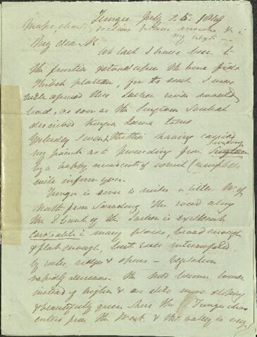
Tungu July 25th 1849
Maps, charts, sections plans answers etc in my next -
My dear B
At last I have been to the frontier and stood upon the bona fide Thibet plateau, for to such I was well assured this Lachen river would leas, as soon as the Singtam Soubah described Kongra Lama to me. Yesterday I went thither having [carried?] my point as to proceeding from Samdong by a happy accident of which Campbell will inform you. Tungu is some 6 miles a little W of North from Samdong. The road along the E bank of the Lachen is excellent [?] in many places broad enough and flat enough, but ever interrupted by hills ridges and spurs - vegetation rapidly decreases, the Mts. become lower instead of higher and are still more sloping and beautifully green - here the Tungu choo enters from the West and the valley is very broad quite flat and with but a stunted Webbiana, Birch and little Juniper. I collected 15 new plants on the road up and 40 more in two hours about the camp. Astragalus Fumaria and other Tibetan types rapidly increasing. The Lachen Soubah waited on me, swore himself to truth and took me to the pass yesterday good 12 miles [and linear?] north of this, with a good road all the way direction about North soon after leaving Tungu 13,000ft cross the Lachen (12 yards, tem 50!) it here runs through a narrow glen with rugged Mts. of P.S. in the west which run North in a splendid line of snowy cliffs called Chomiomo but flanked by low hills along the river and this said loft snowy range is continued South to the fork of the Genui and Lachen is low ranges after passing Tungu above this the Lachen Valley expands and receives 2 streams from Chomiomo, both large, on the [N/W?] are low hills running South from Kinchin jow without a particle of snow. All along the river is flanked by broad stoney flats and spurs with only grass and tufted herbs, a little Juniper (creeping) and Rhododendrons. Some 5 miles up we passed a shallow glen opening up to Chomiomo with [lots?] of Perp. Snow at 14,500ft or 15,000ft. The river meanders and splits much, its [Channel?] very tortuous, and above there feeders from the W, is a placid stream abt. 14,500ft or so. We arrived at the Lachen Soubah's black tents, [gates] and [horses] and were welcomed by his Squaw to a sumptuous meal of Tea with salt and butter, curd, [parched?] rice, maize etc. we halted an hour when a tremendous peal like thunder woke every [?] in the glen, it was a thick fog and drizzle - the Bhoteas started up saying "the mountains are falling, we shall have rain" I was vastly puzzled, for I thought heavy Thunder storm had broken overhead, but it appeared that it really was the noise of falling masses of Kinchin jow and Chomiomo - we started and soon after it poured with rain - the roar of the falling hills was truly terrible and incessant for the hour. I never heard any thing more awful and I cannot say which Mt. contributed the most, they returned salutes and echoes so incessantly. The low hills flanking each prevents a fragment reaching the valley. The rain [ducked us/drenched us?] and cleared off; the valley opened with a funnel mouth and at 15,000ft we were on a bona fide plateau, between these two great Mts. Some 3 or 5 miles apart From either hand low flat terraces all stony and bare slanted up and down, met, joined [missculated?] and waved across the surface for 4 miles more or thereabouts we hardly ascended 500ft to a low very broad and hardly distinguishable E or N ridge, of Kongra Lama, which runs a little N of West from the N.W. extreme of Kinchin jow When on it you find it is culminant, but so low that the cairn on it is not seen half a mile off. The top is an indefinable flat into which other similar low ridges dip, producing so confined a surface that it is impossible to say what was higher and what lower of great broad ridges not 50 or 100ft above the mean level of the land, for 4 miles South and many more North. The Lachen forms a semicircle round this spur from Kinchin jow comes from N.E. of it and flows West along its N. base turns South cutting through, then East and again "South down the valley" - so confusing in the surface that standing at [HERE A TRIANGLE IS DRAWN REPRESENTING A POINT ON THE MAP] Neither Soubah nor Serot could convince me that the Lachen at A was not much lower than at B, and B, lower than C and to their division I had to walk thither some half mile to convince myself - North of A low flat spurs succeed one another, the land dipping very considerably to [Geeree], the [cheneu] but a few miles on where is a Dingpun and guards they say, it is invisible from this at time and now the storm that had pelted us passed over and hid the distance - all assured me that should the clouds lift I would see low ranges of hills with stones, hardly a rock, running in all directions - N. East the plain continues as Cholamoo and was backed at [5 or 8?] miles by a low awkward oblique range of grassy round topped hills ["Pentha-T'Hlu?] say 10 miles long and 1500 above Kongra Lama, pretty steep but not a particle of rock, theyr rise from the N slope of Cholamoo plain belong to nothing and look as if dropped from Heaven. Due E and between East and N.E. was blue sky, vry fine and not a hill of any kind [?] snowy or other one exist in that direction, all were low waving slopes of Cholamoo. Doubiah Lah passs opens on this plateau to the South of East of this Pass hence, as I said on first arriving at Dorjiling my dear Kinchin jow is the nothernmost of all the Sikkim Himalaya and must rise clear out of the Thibetan plateau? and so it does, abruptly in a wall of beare rock and slopes of debris behind which a precipice of snow towers up perpendicularly to 20,000ft capped with prodigious beds of snow west - low spurs of Chomiomo rise out of their plains steppe by steppe and S.W. the [ground] but itself, not inferior to Kinchin jow, reared its walls of snow alas all perpendicular and [trending?] South to a little north of Tunga - South the plateau contrasts as a [farewell?] and then dips down to the valley of Lachen. I walked about a great deal, for views, the people having no objection to my putting foot in Cheen, indeed we halted without Sikkim, but I could get no views, the surface is so wavy that you are lost the moment you leave the roads, as far as knowing by land marks which way to turn - It is like the Dunes in Holland on a gigantic scale, a labyrinth of mere nothings, with the stream so tortuous that you cannot guess which way they run. North of Kongra the Lachen appears all pool and marsh and though at its [?] hardly flows. I thought the flats of its North bank a good deal lower than Kongra which is the flat of its South bank, but nothing but a delicate level could determine that - be that as it may, the Lachen rises from S.E. or rather from the South of East Kongra, flows along Kongra's North flank and appears to cut the ridge between Kongra and Chomiomo and to get down the valley
July 26th
This is a splendid morning and I must make use of it - so cannot write more I was writing all last night and I am excessively busy - Many thanks for the queries of 4th and 7th and the books
Ever yr affect[ionate]
J.D. Hooker
I have finished and send the Terai Journal - very foul I fear, please send it to Campbell when read
P.S. Not a particle of snow the whole way not a speck on Kongra Lama at 15,500 nor for 1000ft up the Mts, facing Thibet. Temp. of Lachen at 15,500 47° at Thlonok at 10,000 you know was 40° Muller will send you the true height of Kongra Lama
Appraisal, destruction and scheduling
Accruals
System of arrangement
Zone des conditions d'accès et d'utilisation
Conditions d'accès
Conditions governing reproduction
Language of material
Script of material
Language and script notes
Caractéristiques matérielle et contraintes techniques
Finding aids
Zone des sources complémentaires
Existence and location of originals
Existence and location of copies
Related units of description
Zone des notes
Identifiant(s) alternatif(s)
Mots-clés
Mots-clés - Sujets
Mots-clés - Noms
- Hooker, Sir Joseph Dalton (Sujet)
- Hodgson, Brian Houghton (Sujet)