Identity area
Reference code
Title
Date(s)
- 15 Jul 1849 (Creation)
Level of description
Extent and medium
1 letter
Context area
Name of creator
Repository
Archival history
Immediate source of acquisition or transfer
Content and structure area
Scope and content
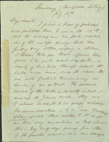
"Samdong" (Campbells Latang)
July 15th 1849
My dear B
I filled 4 pages of foolscap and despatched them to you on the 13th, but the intelligence has just reached me of the coolies having lost his footing and my letters, crossing a stream. I therein told you that I found this place to be quite what I expected, a country of low hills, through which the Lachen river runs 11,500ft above the sea, with flattish terraces along its banks, of no extent. The general nature of the hills is exactly what I saw up the Zemu river, they rise to about 14,000 ft and are grassy and sloping. No snow whatever is to be seen hereabouts and I am assured that neither E.W. or N. (near hand) are there any mountains of Perp. Snow. It is a long half days journey from this to the frontier which is in a low range of hills by this river and thence the route into Thibet, North is for a long day's march, like this sparingly wooded, on the third day you have only grass and the 4th march is amongst [stoney?] ranges with intervening flats the true treeless Thibet. My great Mt. is called [Choyarribo?] said to be a long way N.E. of this and south of Cholomoo rising out of the plain of Thibet. I ascended a S.E. slope today to 14,000ft all grass, no jungle but scanty trees of pine etc. The weather was so bad that my view was limited to the immediate neighbourhood of my position and I was at 14,000 amongst shallow valleys quite unlike anything Himalayan, all grassy with scarce a patch of snow. The Himal. flats ascended full 1000ft higher than any where I have been and I doubt not the snow line is [proportionally] elevated. I procured a great many new plants, some of them Thibetan type. The Lachen river runs north from this 1 1/2 march, through low hills and flats and then turns East to Cholomoo. My information is gradually becoming more precise and I have had long talks with the Singtam Soubah, who appears intelligent and trusty and knows the Lachoong route well. He assured me there is no snow north of this on to Dijauli where the road is highest he cannot exactly say, but 3 marches beyond this were the roads join all is [blue?] and you descend all the way to Dijauli of this he is positive. All agree calling country Mai'dan even my Lepcha and Bhothea coolies and this I confess staggers my preconceived notion of the Thibetan plain and has led me to make the most pointed enquiries. Happily I have now, what I always wanted, a modicum of [comparison?] and both the Singtam and Lachen Soubahs, and others agree in the affirmation, that hence north of Dijauli the country is very like this only the hills are lower, quite naked and still more sloping, the flats larger No villages are seen from any distance, and it is up and down the whole way. The road winds amongst high hills and crosses lower, is always good through stoney, crosses no snow but little patches are frequent on many ridges which rise above the valleys as high as those above the river. Dijauli is very cold stoney and barren and mountainous or hilly. Perpetual snow lies very sparingly on some of the ridges seen in various directions north of [Zalies?] interspersed. He too asserts that the general features of Thibet are like this all I can say is, that this country is as little like Sikkim as it is to my preconceived notion of Thibet and I was particularly struck with the mt. valleys this morning and considering how violent the contrast is between these hills, valleys and [roads?] and them only 5 miles south of us, I do now wonder at the people calling calling Maidan though the bona fide flats is incomparably inferior to the [Yangma?] terraces, in extent and level surface. The Soubah says I shall see as much and as long as I like from Lachung, over the plain of Thibet and Cholomoo but that I shall see range upon range of hills and very little flats like this river terrace, all stoney and barren, with snowy mountains about. The descent from Lachong to this Cholomoo Maidan is not great - If as it appears Choyarribo is near Cholomoo and in sight close to Powhunry, the Cholomoo plain cannot be expected to be very level and if further, Powhunry be with [Doubia Lah?] - three such mountains indicate a very rugged country - my notion is yours too, that a table land extends N of [Sikkim] this declines no doubt from Powhunry (perhaps from Chumalari) west to my position - it also declines north to the [Yarron?] I am now assuredly well north of all characters [in?] Himalayan features in this longitude though not if the watershed which high or low (undoubtedly lower than the ranges South of me) is the true Himalayan axis - I feel myself quite out of Sikkim here, though by no means in Thibet, still I could fancy myself in a table land this morning, when at 14,000ft I wandered amongst broad mountain ridges with shallow valleys, no snow and the rocks only cresting the ridges - [?] and access the [Yarron?] (which flows near to and little below the level of this town) the hills are more rugged and the flats smaller, but none rise to such height, though so rugged and incessant, that it is a months journey for laden yaks to the Salt Country which is no great actual distance. From Dijauli east to the 'great lake of the Yarron' (these people call it) the whole country is mountainous-flats of various extent like that of [P'haii?], some sandy, some stoney, all bare, access between all the ridges - The villages are never seen from a distance and all like this collection of stone hovels on the slopes of flats between the ranges. Llasa stands on a great plain, its Gompas being visible for half a day's journey all round. The horizon is rocky and very hilly but the Soubah does not recollect seeing perpetual snow any where. There is no plain as large as Llasa any where else that he knows of in Thibet. The town itself is hilly and hence [?] no other part if the plain of Thibet is plain like Llasa all is Mai'dan like this! but not a continuous flat of half a day's extent. The Yarron is very rapid, but no where cuts a very deep channell its bed rocky in many places. Below Llasa of it is navigable, but he has seen no boats above that town and there are none at Dijauli i.e. he saw none P'haii occupies a mai'dan surrounded by high hills exactly like these, but bare and stoney after leaving it and crossing three hills, you descend towards Dijauli always crossing other low ranges. One of my coolies, an excellent man knows it well and confirms this. He says that all round the base of Chumulari are ranges of stoney hills with flats every where I have indeed toiled for views, and would give willingly 1000R for a good prospect from 15000ft but so uniformly misty in this region that I quite despair, and often think how much credit is due to travellers, who toil for geographical discovery alone, with no love of Natural History to draw them in. What I saw today, and from the Zemu, perfectly coincides with what the people say of all these hill tops, that they are broad grassy, with shallow ravines and no great mountains amongst them - how far we are to trust their further comparison with the Thibetan Plateaux, is another question. Lachang should tell us volumes - what weighs most with me is that throughout my long conversations with my own collies, Nimbo and the Soubahs, they are always referring to and comparing with the features around me, in E. Nepal and Sikkim. I never could elicit the remotest comparison. You have every where and every day's march mountains like there is their constant affirmation, now this has all the appearance of a very mountainous plateaux, and is no doubt the verge of the Thibetan ditto thought better grassed, wooded and watered, and more varied, though perhaps equally free from very lofty ridges or [peaks] and very deep valleys. Little rain falls here, and little snow in Winter comparatively speaking, though enough to render it uninhabitable further south the rain and mist become gradually less and less ceasing where the vegetation ceases. It is very windy too here, another Plateaux feature. 17th I have had another talk with the Singtam Soubah who questioned me about England and Calcutta he has been to Pumeah and volunteered the remark that the [Cheen] Maidan was quite another affair [than] that of Pumeah the latter was a flat maidan, the former no where so flat and every where mountainous. I am bothered again about getting to the Pass, the Tchebu Llama's letter (which I could not get translated till arriving here) says nothing about a hill pass - only "take the Sahib to the frontier beyond Samdong" - I am at Samdong and the Lachen Soubah is [?] on at a fearful rate. The Singtam Soubah is the head man but I prefer his ignorance. I have acquainted (Campbell with further particulars) I hope he will get the Tcheba Llama to write to the Singtam Soubah and tell him as he did Campbell what the Pass really is - I [?] [?] insisting on Kongra [Pahar/Pabat?] and the stone boundary. What a shuttlecock I have been this past 3 months
Ever your affectionate Jos. D. Hooker
P.T.O
Notes on paper appended to first page of letter
B.H. Hodgson
With a skin and bottle
You need not return me Darwin's letter nor the others
Appraisal, destruction and scheduling
Accruals
System of arrangement
Conditions of access and use area
Conditions governing access
Conditions governing reproduction
Language of material
Script of material
Language and script notes
Physical characteristics and technical requirements
Finding aids
Allied materials area
Existence and location of originals
Existence and location of copies
Related units of description
Notes area
Alternative identifier(s)
Access points
Subject access points
Name access points
- Hooker, Sir Joseph Dalton (Subject)
- Hodgson, Brian Houghton (Subject)